We can divide the development of the telegraph system into six phases, which you can observe as you scroll down.
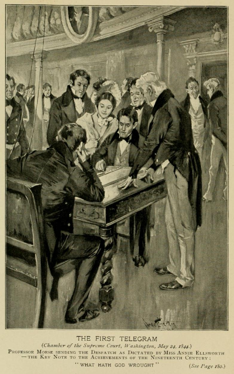
In 1844, the federal government funded the first telegraph line in the United States to see whether Samuel Morse's telegraph invention worked. You will see this first line between Washington and Baltimore. The stations opened to the public the next year.
The experimental line worked, so in 1845 new telegraph companies built lines to connect the biggest cities in the Northeast. Watch these lines grow between 1845 and 1847. The biggest users of telegraphs were business people and newspapers, who clustered in big cities, so it made sense to build telegraphs to connect them.
The first telegraph connected New York to St. Louis, on the western border of the East, in 1847. The next few years saw lines push south to New Orleans (the biggest market for agricultural goods from the center of the country because products floated south on the Mississippi River) and north to Canada. Watch lines and offices grow denser in subsequent years.
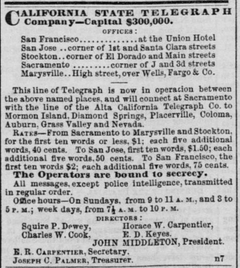
The first telegraphs on the Pacific Coast connected gold mining towns in the Sierra Nevada to the market cities of Sacramento and San Francisco. Watch the first lines appear east of San Francisco.
In the 1850s, six companies took over most of the telegraph networks in the East. In 1857, the six companies formed a cartel to help each company monopolize a different region.
In the late 1850s, companies in California and Missouri built lines toward each other along two routes. One, called the Central Route, crossed the waist of the country. The other, called the Southern Route, swung southward. You can see growth along both routes using the slider. For eighteen months, the Pony Express ferried telegrams between the Eastern and California systems. In 1861, a gigantic push from both sides completed the transcontinental telegraph system on the Central Route. The Southern Route effort was put aside until later.
Some features of the map are tied to dates, so they will change as you adjust the time slider. These features are telegraph networks (stations, lines, and regional monopolies), mail routes, Native American cessions and reservations, historic states and territories, and railroads.
To show a mail route, the time slider must be within the dates the route operated. For example, the Pony Express operated from April 1860 to October 1861. To see it, (a) position the time slider within that range and (b) check Pony Express (letters and telegrams) in the layer list in the lower right.


Scroll through the time slider to examine how the network developed from one route between Washington, DC and Baltimore to a transcontinental route, and then click a station or line to get more information.
Additional layers will become available as you move the time slider and zoom in and out.
Explore the map using the following tools:
Please note that this map is a work in progress. It displays the data we have collected so far, but it is not a complete map of all telegraph stations and lines.
This work is licensed under CC
BY-NC-SA 4.0![]()
![]()
![]()
![]()
This work is licensed under CC BY-NC-SA 4.0![]()
![]()
![]()
![]()